 Open the atlas
Dissertation data
Administrative Litigation and Land Development
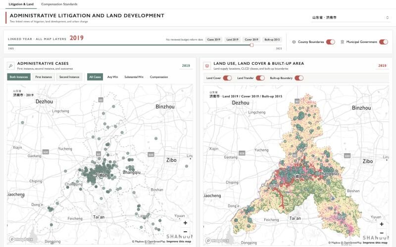
A dual-pane atlas of the data behind my dissertation. The left map plots administrative court cases for a selected city and year; the right map overlays land transactions, land cover, and the built-up boundary for the same place. Pan or zoom either map and the other follows.
A second tab maps county-level land-taking compensation standards (yuan per mu) for all 31 provinces from 2010 to 2026. Each province has its own timeline, because each revises its schedule on its own calendar.